- Published on
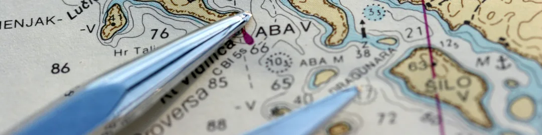
Understanding how to read nautical charts is one of the most important skills for safe sailing. These special maps are packed with information about water depth, hazards, landmarks, and routes. In this guide, we’ll break down the essentials so you can confidently plan and navigate your sailing trips.
What Is a Nautical Chart?
A nautical chart is a map designed for marine navigation. Unlike road maps, charts show:
• Water depth (in metres or feet)
• Underwater hazards (like rocks or wrecks)
• Buoys and markers
• Tides and currents
• Navigation routes
• Shorelines and land features
A nautical chart is a map designed for marine navigation. Unlike road maps, charts show:
• Water depth (in metres or feet)
• Underwater hazards (like rocks or wrecks)
• Buoys and markers
• Tides and currents
• Navigation routes
• Shorelines and land features
You can get nautical charts in two main formats:
• Paper Charts: Good backup for electronic failures
• Electronic Charts (ENCs): Used with chartplotters or navigation apps
Key Features on a Nautical Chart
1. Depth Contours and Soundings
• Numbers on the chart show how deep the water is at low tide
• Depths may be in metres (UK) or feet/fathoms (USA)
• Shaded areas often indicate shallow zones
2. Navigational Aids
• Buoys: Floating markers that guide you through safe water
• Lighthouses: Mark coastlines and hazards
• Daymarks: Fixed signs used during daylight
Learn the IALA buoyage systems (Region A for UK/Europe, Region B for USA/Canada) to understand what each marker means.
3. Hazards and Obstructions
• Look for symbols that mark rocks, wrecks, reefs, and sandbars
• These help you avoid dangerous areas
• Look for symbols that mark rocks, wrecks, reefs, and sandbars
• These help you avoid dangerous areas
4. Latitude and Longitude
• The grid of horizontal and vertical lines
• Used for GPS and plotting your position
• The grid of horizontal and vertical lines
• Used for GPS and plotting your position
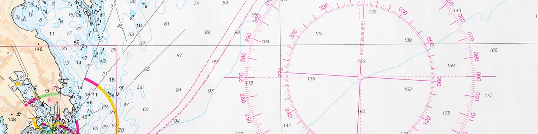
5. Compass Rose
• Shows true and magnetic north
• Helps you set and follow courses
How to Use a Nautical Chart
Step 1: Identify Your Starting Point and Destination
• Use known landmarks, marina names, or GPS coordinates
Step 2: Plot Your Course
• Draw lines between waypoints
• Avoid hazards and shallow areas
• Plan alternate routes in case of weather or tide changes
Step 3: Check Tides and Currents
• Use a tide table or app
• Tidal height can affect where you can safely sail
Step 4: Use a Parallel Ruler and Dividers (for paper charts)
• Measure angles and distances
• Compare with the compass rose
• Measure angles and distances
• Compare with the compass rose

Some Electronic Charting Tools
Many sailors today use apps or chartplotters with GPS:
• Navionics (available in UK/USA)
• iNavX
• Savvy Navvy
• OpenCPN
These apps provide live tracking, tide data, and automatic route planning. But don’t rely solely on tech—always carry a paper chart and compass as backup.
Tips for Reading Charts Safely
• Always know where you are: Check your position often
• Understand chart symbols: Use a legend to decode icons
• Watch scale and zoom: A small detail may be missed when zoomed out
• Stay updated: Charts can go out of date—check for updates
• Practice regularly: Get comfortable plotting on paper even if you use electronics
⸻
Helpful Chart Resources
• UKHO (UK Hydrographic Office)
• NOAA Nautical Charts (USA)
• Navionics App
• OpenCPN Free Navigation Software
• IALA Buoyage Explained
⸻
Learning to read nautical charts gives you greater freedom and safety on the water. With a bit of practice, you’ll be able to navigate confidently, plan better routes, and avoid trouble spots with ease. Stay sharp, and happy sailing!
0 Comments